
Finding Ocean Street Directory Clues
A street-by-street search begins with a legal municipality and an exact property location. The county Tax Board uses parcel information, while the County Clerk index carries the document trail. The public voter lookup is a narrow exact-match tool, and historical directories supply evidence only for their editions. None alone establishes every current person at an address.
Keep a research note for the street spelling, postal city, legal municipality, parcel identifier, source date, and record type. That small discipline prevents a mailing address, a title party, or an old subscriber from being mistaken for a present household.
- Find the address in the Tax List Search by municipality and property location.
- Record block, lot, qualifier, situs, mailing field, and deed book/page from the parcel card.
- Open the Ocean GIS hub to view parcel, boundary, and tax-map context.
- Search the Clerk index by legal description, parties, date, book/page, or map reference.
- Use a dated criss-cross or phone directory only when it covers the street and year.
Ocean Street Directory Municipality Check
Before using a street record, identify the legal municipality. Ocean County's official municipality directory shows the county's 33 governments. Postal place names and municipal names can diverge, particularly on Long Beach Island, in small bayside boroughs, and around Toms River. A municipal clerk or assessor, not a postal label, is often the correct keeper for address-linked local material.
Historic searches need date-aware names. The place now called Toms River Township was Dover Township until 2006. A deed, directory, map, or municipal file can use the older name. Retain the source-era name beside the modern cross-reference instead of silently replacing it.
Postal geography should also be recorded with care. A ZIP code can serve more than one municipality, and a municipal office can use a postal city that is not the legal place named in a tax or planning file. The USPS address result is the delivery check, while the municipality field keeps the street record attached to the right local custodian.
Ocean Street Directory Parcel Fields
The Ocean County Tax List Search is parcel-centered. It exposes municipality, block, lot, qualifier, property class, and property location fields. The result card can carry a deed date, mailing address, situs, value and sale history, previous parcel identifiers, book/page, and property characteristics. Those fields provide a reliable address-research bridge, but the observed portal did not expose a countywide owner-name search.
| Field | Type | Street-directory use |
|---|---|---|
| Municipality | Select | Sets the tax jurisdiction. |
| Block | Text input | Identifies the parcel block. |
| Lot | Text input | Identifies the parcel within its block. |
| Qual | Text input | Adds a local qualifier when used. |
| Property location | Text input | Searches the situs or street location. |
The Ocean County parcel-detail route illustrates the assessment, sale, and deed-reference fields available after a parcel search.
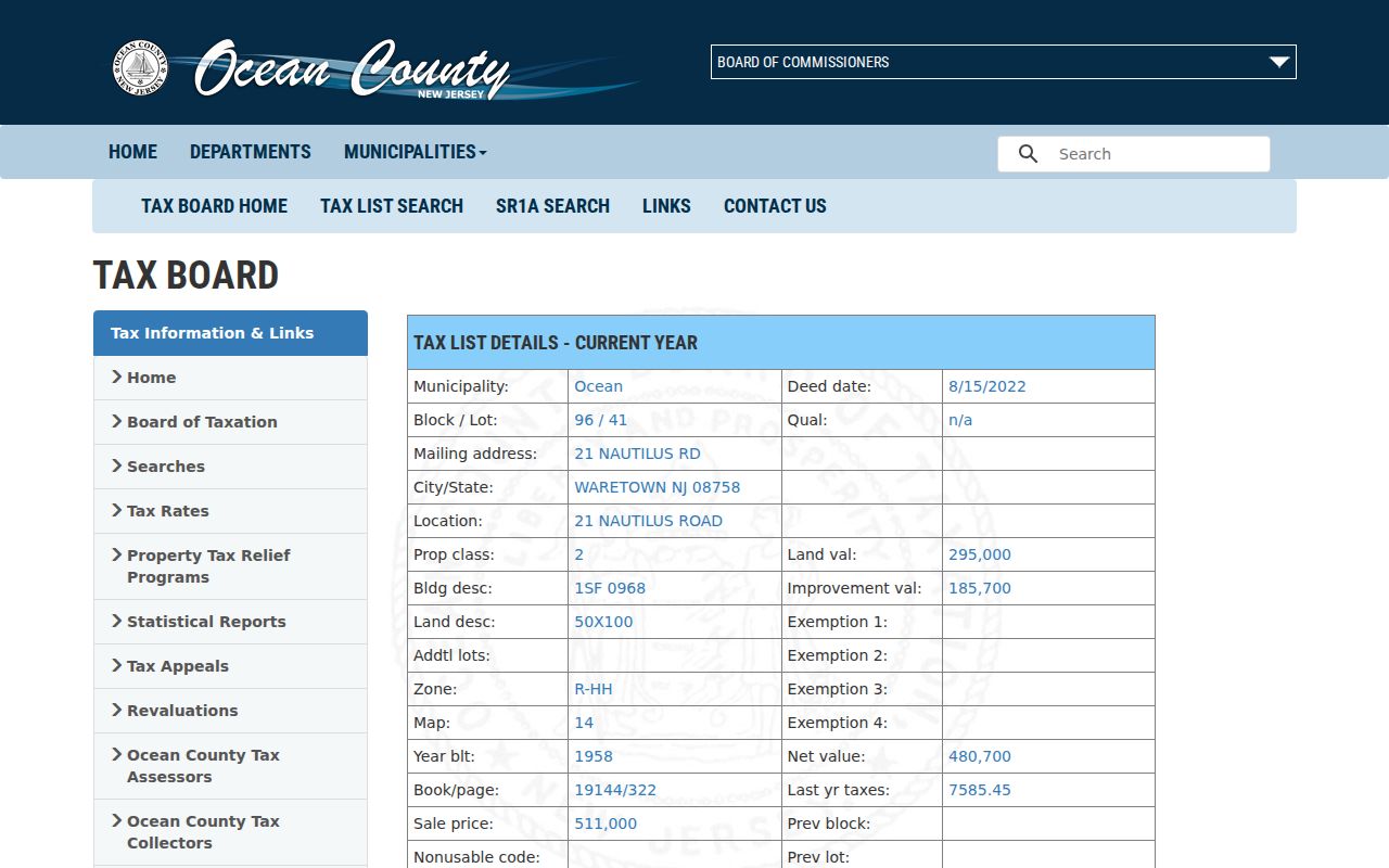
The card makes parcel identifiers visible for the next deed or map step, while its mailing field still is not proof of occupancy.
Ocean Street Directory GIS Layers
The Ocean County GIS catalog links the public ArcGIS hub and geographic downloads. Relevant layers include parcels, municipal boundaries, tax maps, aerial imagery, zoning, FEMA flood zones, easements and rights-of-way, wetlands, parks, and subdivision or site plans. GIS is best for spatial relationships and parcel identification. It does not establish who currently lives at a selected point.
For a street, turn on parcel and municipal-boundary layers, record the parcel identifier, then use that identifier in the Tax Board and Clerk systems. A boundary, road, water area, common element, or easement may appear beside a home. Preserve that map label rather than counting every polygon as a household.
The county GIS catalog identifies the mapping and download resources available for Ocean street research.
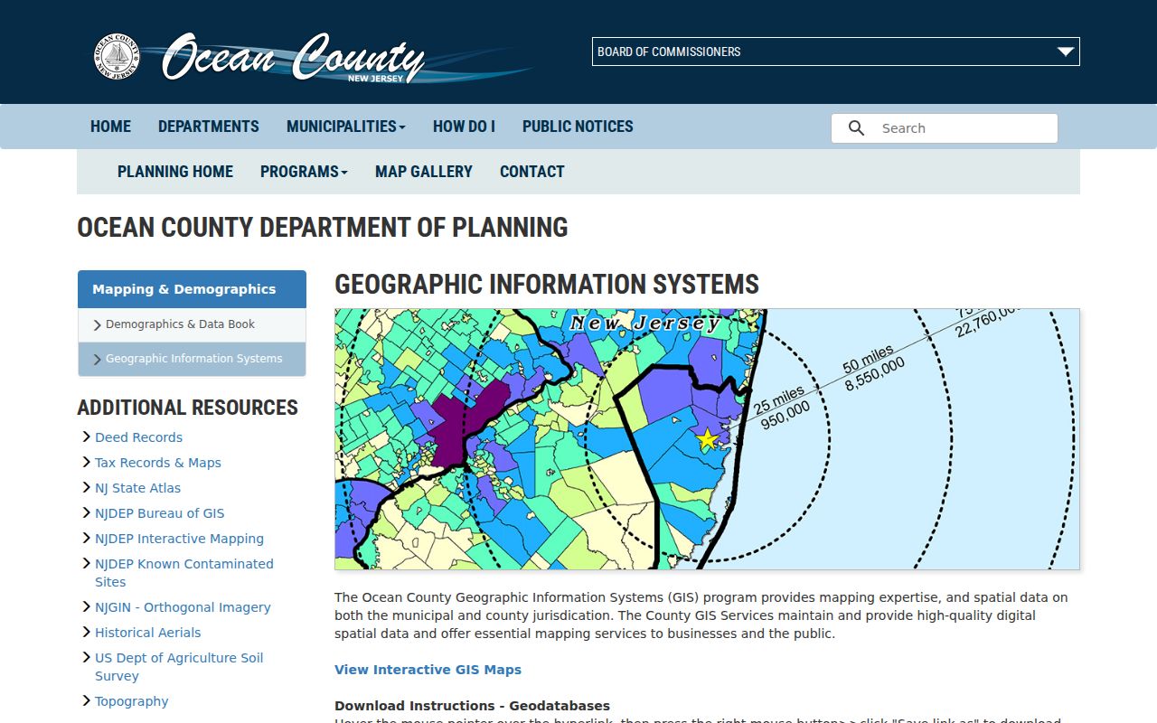
The map layer is a bridge to the parcel and deed records, not an ownership or residency conclusion by itself.
Ocean Street Directory Deed Trail
The Ocean County Clerk search covers official records recorded from April 1, 1977 forward. SearchNG supports party names, ALL/ANY logic, document groups, dates, book/page, file numbers, consideration, town, lot, block, map number, images, and linked documents. A party search can be broadened with prefix matching, more names, or a two-party condition when the document facts support it.
Search linked mortgages, assignments, releases, satisfactions, and discharges along with a purchase deed. Each can identify a relationship to a recorded instrument, not a current resident. When the online index stops, the documented fallback is county deed books, State Archives microfilm, county originals, or the digitized historical route described by the Archives.
SearchNG help documents the Clerk system's name, document, date, legal, map, linked-document, and image tools.
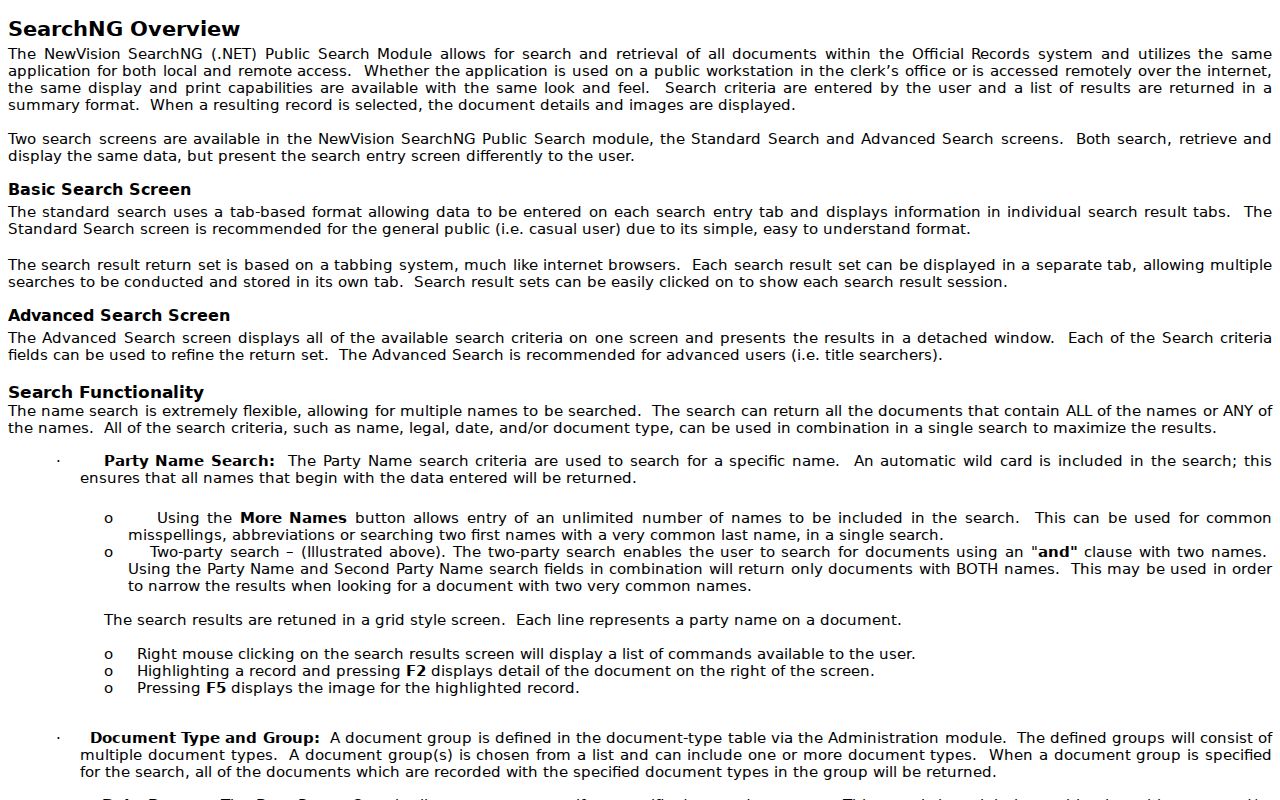
Saving the exact query and result date helps distinguish an original instrument from a later linked filing.
The Clerk's records and forms page says a person can use the computer index to find a document and request an image or hard copy. Current recording fees and printing conditions should be confirmed from that live page. An unofficial or watermarked result can still identify the document details needed for a custodian request.
Ocean Street Directory State Parcel Route
The New Jersey Geographic Information Network parcel page and Property Explorer can search by address, county, municipality, block, and lot. The statewide layers are useful when checking a parcel boundary or a cross-jurisdictional map. They may redact owner names under Daniel's Law, and county and state boundaries may not edge-match near another county.
Use Ocean County's official tax map and parcel sources when the address is within the county. A redacted name or address is not a puzzle to solve from uncontrolled copies. Keep the redaction notice and source date with the street-directory result.
The New Jersey parcel-data page provides the state-level address and parcel route.
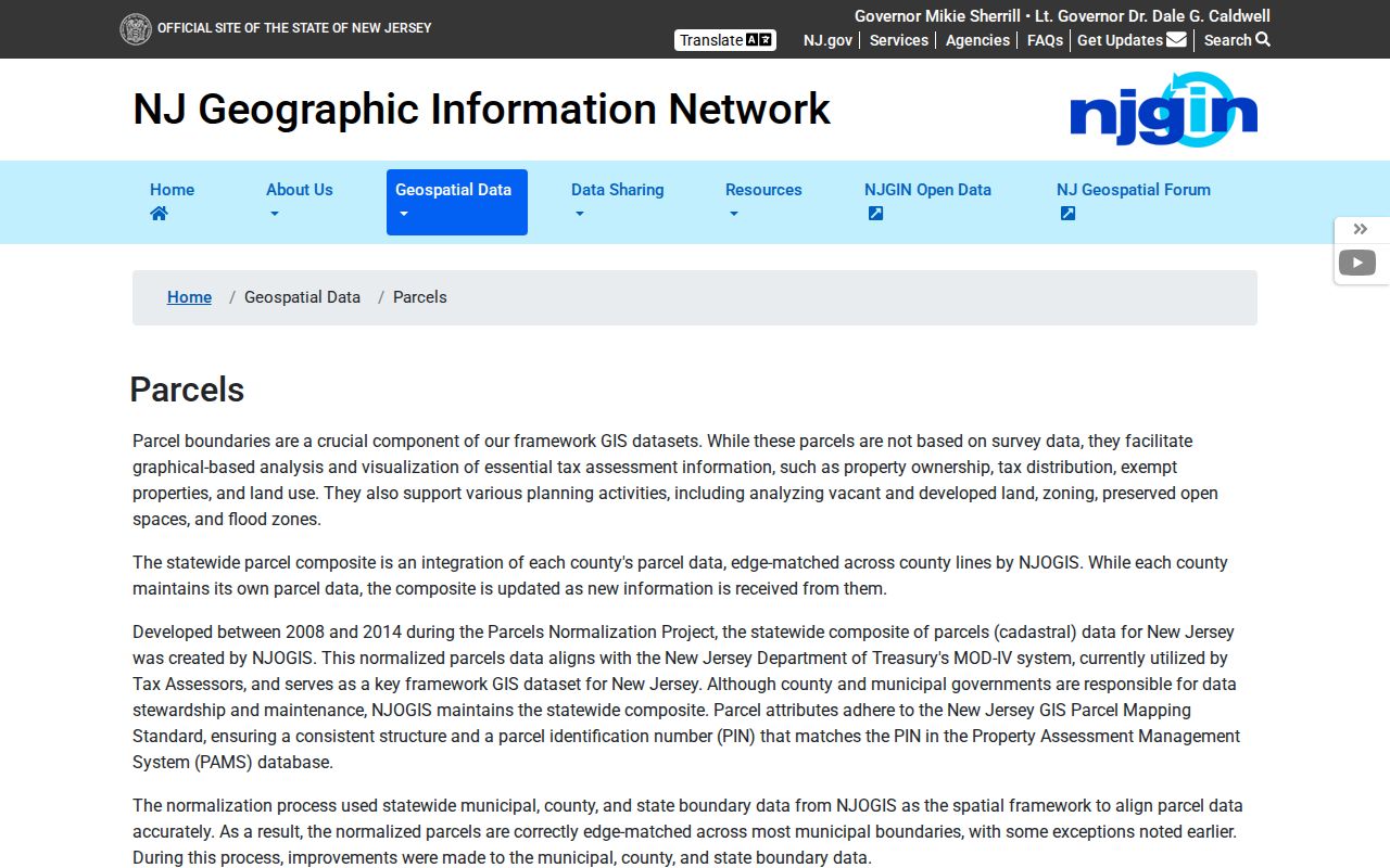
It complements county parcel research but does not replace the Ocean tax record for an in-county address.
Ocean Street Directory Record Coverage
Address-keyed records answer different questions along the same Ocean street. Combine them by date and identifier instead of making a single result carry more weight than it has. The parcel number and legal description are more stable bridges than a short street-name search, particularly where municipal or postal labels differ.
| Record set | Keeper | Street evidence | Access |
|---|---|---|---|
| Parcel and assessment card | Board of Taxation | Situs, mailing, values, sale and prior parcel fields | Public parcel portal |
| GIS parcel layers | Planning | Geometry, maps, boundaries, imagery and planning context | Public viewer/downloads |
| Recorded instruments | County Clerk | Parties, legal description, dates, book/page and linked filings | SearchNG from April 1, 1977 |
| Voter route | NJ Elections and County Board | Narrow lookup or requested statutory record | Exact match or signed form |
| Directories and phone books | OCL, Wheeler Room, OCHS | Dated address-to-household clues | Repository-specific |
Note: A property location and a mailing address may differ, so neither field should be written as a present-residence fact without additional evidence.
The narrow New Jersey voter screen does not offer a casual block browser. Its documented exact-match route uses first name, last name, and date of birth, while a fuller county request uses the signed election form. A street directory should not turn a voter record into a house-by-house list when the custodian has not provided that public access route.
Ocean Street Directory Historical Addresses
For a past household, the Ocean County Library, Wheeler Room, and Historical Society provide directories, phone books, newspapers, yearbooks, maps, and local indexes. The State Library identifies Polk's Toms River editions for 1963, 1966, and 1969, including Beachwood, Island Heights, Ocean Gate, Pine Beach, and South Toms River. The Historical Society has telephone directories for 1956-57, 1970-2007, 2010, and 2014, with gaps that must be noted rather than filled by assumption.
Criss-cross directories arrange clues by address, while a regular directory may arrange names first. Pair an edition with a census, deed, newspaper, or probate date before tracing a household. The Ocean city directory collections page lists the historical shelf and its access conditions.
- Parcel
- A defined land unit tracked by municipality, block, lot, and sometimes a qualifier.
- Situs address
- The physical property location, which can differ from a mailing address.
- Plat
- A map or plan that depicts lots, streets, and other land divisions.
- Criss-cross directory
- An address-arranged volume providing dated household or subscriber clues.
Ocean Street Directory Historic Map Context
The Library of Congress 1872 Ocean County map records landowners, lots, communities, business-directory material, and village insets. The 1922 Lakewood Sanborn set provides building and street context on 24 sheets. These maps are useful for forming a historic location question, then testing it against deeds, directories, newspapers, and archives. Neither map establishes a modern owner or resident.
When an old street record uses Dover Township or an early township label, search the predecessor name. Ocean County was formed from Monmouth County in 1850, so earlier property and family material can be filed under Monmouth or the relevant township. This is a records-geography issue, not a reason to combine people with the same surname.
Use a source date with every historic street clue. The 1872 map can suggest a landowner and lot, while the Lakewood Sanborn sheets describe structures and street setting in 1922. Later deed records, census material, and printed directories must be added in sequence rather than used to fill unobserved years between those sources.
Ocean Street Directory Custodian Requests
Some street history is held outside online tools. The correct fallback is a focused request to the municipal clerk, planning office, or other custodian for an existing record such as minutes, permits, a plan, ordinance, or defined file. Under the New Jersey Open Public Records Act, describe the municipality, date range, street or parcel, and record family. Do not ask an office to create a chronology that it does not keep.
The county's live fee pages and local forms should be checked before submitting a request. A response can lead to a record already online, an agency-specific form, a fee estimate, an exemption, or an archives route. Record that outcome instead of treating a missing web result as proof the history never existed.
Ocean Street Directory Privacy Limits
An Ocean street directory cannot reliably show every household member, current occupancy, protected address, or personal vehicle record. The tax card is not an occupancy roll. The Department of Motor Vehicles information is restricted under DPPA rules, and Daniel's Law or the Address Confidentiality Program can require redaction. The voter file has public and protected layers, with access controlled by the official process.
Use address records for lawful personal research, family history, estate work, property curiosity, or civic context. Do not attempt to reconstruct a protected address or contact someone through information that a custodian has withheld.